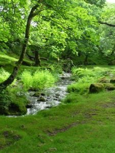
 The Parish of Burrator is in the south west corner of the County of Devon, wholly within the Dartmoor National Park. The Parish straddles the upper reaches of the Meavy and is framed by the Walkham and Plym Rivers. Our terrain is of moorland, dry stone enclosed farmland and wooded river valleys. The eastern and northern skylines are broken by the granite hill top tors for which Dartmoor is famous.
The granite quarries, tin mines and railways that once provided employment now exist as relics and landscape features softened by time.Burrator is a place of both natural beauty and artifice. The Parish is home to Burrator Reservoir after which the Parish takes it name. The Reservoir formed by flooding the Meavy valley at the end of the 19th century, with its many surrounding granite tors, moorland and woodlands provide a famous beauty spot attacting walkers, cyclists, horse riders and those who just come to look in all seasons of the year.In all, Burrator is one of the largest and most sparsely populated Parished in England, over 5945 hectares. 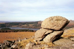
Ancient manors and hamlets are found at Hoo Meavy, Meavy Barton, Goodameavy, Lovaton and Welltown. There are four larger settlements within the Parish: Meavy, Sheepstor, Dousland and Walkhampton. The Parish provides for excellent days out incorporating a pub lunch and a circular walk, see our page “Walks in the Parish” for ideas. Also refer to the “Local Links” which will give you access to websites detailing events, activities and places to stay on Dartmoor